
Is Africa the Largest Continent on Earth?

No, Africa is not the largest continent on Earth. While immensely significant in size and cultural richness, the title of the largest continent belongs to Asia.
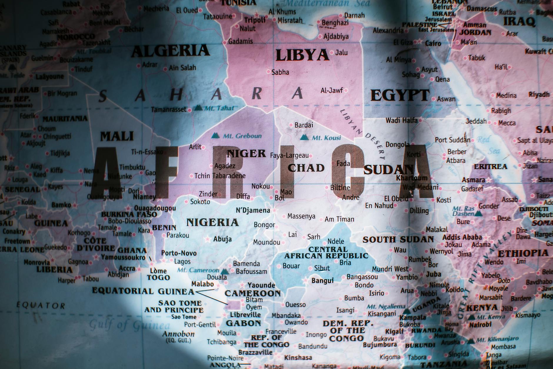
Unpacking the Size Discrepancy: Why Africa Isn’t Number One
Africa is undeniably vast, covering approximately 20% of the Earth’s total land area. Its influence on global history, biodiversity, and culture is immeasurable. However, when it comes to raw landmass, Asia holds the undisputed lead. Asia’s size clocks in at approximately 44.6 million square kilometers (17.2 million square miles), dwarfing Africa’s 30.37 million square kilometers (11.7 million square miles). This difference translates to a significant 47% larger land area for Asia.
It’s crucial to distinguish between area and population. While Africa’s population is rapidly growing and projected to be one of the largest in the world by the end of the century, Asia currently holds the record for the most populous continent. Furthermore, Africa’s size perception might be skewed by Mercator projection maps, which distort the relative sizes of landmasses, especially near the poles. These maps often exaggerate the size of countries in the Northern Hemisphere, making Africa appear smaller than it actually is in relation to those areas.
Frequently Asked Questions (FAQs) about Continental Size and Africa
These FAQs delve deeper into the complexities of continental sizes, focusing on Africa’s position and comparative aspects.
FAQ 1: What is the Definitive Ranking of Continents by Size?
Here’s a list of the continents ranked by total area (including islands):
- Asia: 44.6 million sq km
- Africa: 30.37 million sq km
- North America: 24.23 million sq km
- South America: 17.84 million sq km
- Antarctica: 14.2 million sq km
- Europe: 10.18 million sq km
- Australia: 8.526 million sq km
What colours are fish most attracted to?
Can you put your finger in a trout's mouth?
Is methylene blue anti bacterial?
Does aquarium salt raise pH in aquarium?
FAQ 2: How is Continental Size Measured Accurately?

Continental size is typically measured by adding up the total land area of all the countries and landmasses that comprise the continent, including associated islands. This measurement utilizes geospatial data, satellite imagery, and advanced mapping technologies to ensure precision. While the definition of continental boundaries can sometimes be debated (particularly between Europe and Asia), established conventions are generally followed.
FAQ 3: Why Does the Mercator Projection Map Skew Our Perception of Africa’s Size?
The Mercator projection, created in 1569, preserves shapes and angles, making it useful for navigation. However, it achieves this by distorting the size of landmasses, especially those farther from the equator. This means that areas near the poles, like Greenland and Russia, appear disproportionately large compared to countries closer to the equator, like those in Africa. Using equal-area projections or globes provides a more accurate representation of relative sizes.
FAQ 4: What are some Common Misconceptions about Africa’s Geography?
One common misconception is that Africa is a single, homogenous entity. In reality, it is a continent of incredible diversity, encompassing a vast array of cultures, languages, climates, and landscapes. Another misconception is that Africa is primarily a desert. While the Sahara Desert covers a significant portion, Africa also boasts lush rainforests, savannas, mountains, and fertile river valleys.
FAQ 5: Does Africa’s Size Influence its Biodiversity?
Absolutely. Africa’s vast size and diverse climates contribute significantly to its rich biodiversity. The continent is home to a remarkable array of plant and animal species, including iconic creatures like lions, elephants, giraffes, and gorillas. Its varied ecosystems, from tropical rainforests to arid deserts, support a wide range of life forms, making Africa a crucial hub for global biodiversity.
FAQ 6: How Does Africa’s Size Compare to the United States and China?
Africa is considerably larger than both the United States and China. The United States has a total area of approximately 9.8 million square kilometers, while China has a total area of around 9.6 million square kilometers. Africa, with its 30.37 million square kilometers, is roughly three times the size of either country. This comparison emphasizes the sheer scale of the African continent.
FAQ 7: What Role Does Africa’s Geography Play in its Development?
Africa’s geography plays a complex and multifaceted role in its development. Its vast size presents logistical challenges related to infrastructure development, transportation, and communication. However, it also offers abundant natural resources, including minerals, arable land, and water sources, which can be leveraged for economic growth. Understanding and managing these geographical factors is crucial for sustainable development in Africa.
FAQ 8: Which African Country is the Largest by Area?
Algeria is the largest country in Africa by area, covering approximately 2.38 million square kilometers (919,595 square miles). This makes Algeria larger than countries like Saudi Arabia and Mexico. Its predominantly desert landscape contributes to its substantial size.
FAQ 9: How Does Africa’s Coastline Length Compare to Other Continents?
Despite its vast size, Africa has a relatively short coastline compared to its land area. This is because its shape is relatively compact compared to continents like Europe, which has a highly indented coastline due to numerous peninsulas and islands. The shorter coastline can limit access to maritime trade and resources for some African nations.
FAQ 10: Are There any Disputed Territories Affecting Africa’s Total Land Area Calculation?
Yes, there are some disputed territories in Africa that can potentially affect the precise calculation of its total land area. These territorial disputes, often stemming from historical conflicts or border disagreements, can lead to variations in reported figures. Resolving these disputes through peaceful negotiation and international law is essential for accurate land area data.
FAQ 11: How Does Africa’s Elevation Range Contribute to its Diverse Climate Zones?
Africa’s diverse elevation range, from sea level to the towering peaks of Mount Kilimanjaro and Mount Kenya, contributes significantly to its varied climate zones. High-altitude regions experience cooler temperatures and greater precipitation, while low-lying areas are typically warmer and drier. This interplay of elevation and latitude creates a mosaic of climates, supporting a wide range of ecosystems and human activities.
FAQ 12: What are Some Resources for Accurately Visualizing Africa’s Size and Shape?
Several resources provide accurate visualizations of Africa’s size and shape:
- Equal-area map projections: These projections, such as the Gall-Peters projection, prioritize accurate representation of land area, minimizing distortion.
- Globes: Globes offer the most accurate depiction of the Earth’s shape and relative sizes of continents.
- Online mapping tools: Websites like Google Earth and others offer interactive maps that allow users to compare the size of Africa to other regions and countries. Look for options to display equal-area projections within these tools.
By utilizing these resources, we can gain a more accurate and nuanced understanding of Africa’s true dimensions and its place within the global landscape.